Sharing of Museum Biodiversity Data on the Web
By Brad Millen, Database Technician (Ornithology)
Since 2004 our Vertebrate Collection(s) based records have been made available to researchers and the public on multiple web sites. We license them to be used under Creative Commons Licenses. Currently the Vertebrates release data under the Creative Commons, Attribution-NonCommercial 3.0 Unported (CC BY-NC 3.0).
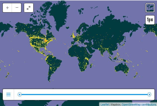
Our collections data have a large percentage of records that are georeferenced and are usually represented by a map interface on these Wide Area Networks.
Recently we have had specimens from the Bird Collection represented on Canadensys with more collections data from other Vertebrates to come. Each small dot on these maps below represents specimen(s) with geographic coordinates.
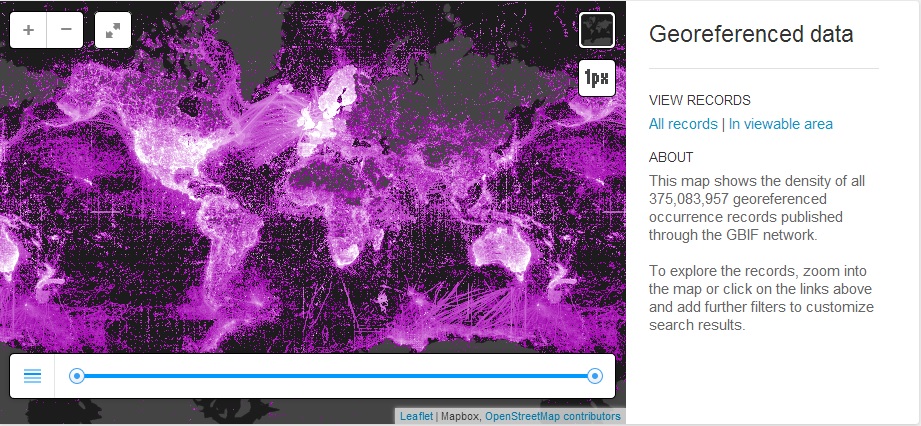
This is the same data as represented by GBIF – the Global Biodiversity Information Facility – 440,884,316 records of observations and specimens, 1,454,695 species, 15,146 datasets, 609 data publishers.
The below is all specimens that appear and are georeferenced on GBIF.
Another important resource to consider is VertNet. VertNet is essentially North American Data providers with 12,851,241 records from 143 data resources shared by 59 publishers. All of the above data on VertNet appears on GBIF.
Currently we are publishing 509051 records on the web with more to come.
These websites are oriented to researchers but can be used by any one with the inclination.